File:Armenia regions map.png
預覽大小:632 × 600 像素。 其他解析度:253 × 240 像素 | 506 × 480 像素 | 809 × 768 像素 | 1,079 × 1,024 像素 | 1,316 × 1,249 像素。
原始檔案 (1,316 × 1,249 像素,檔案大小:259 KB,MIME 類型:image/png)
摘要
| 描述 |
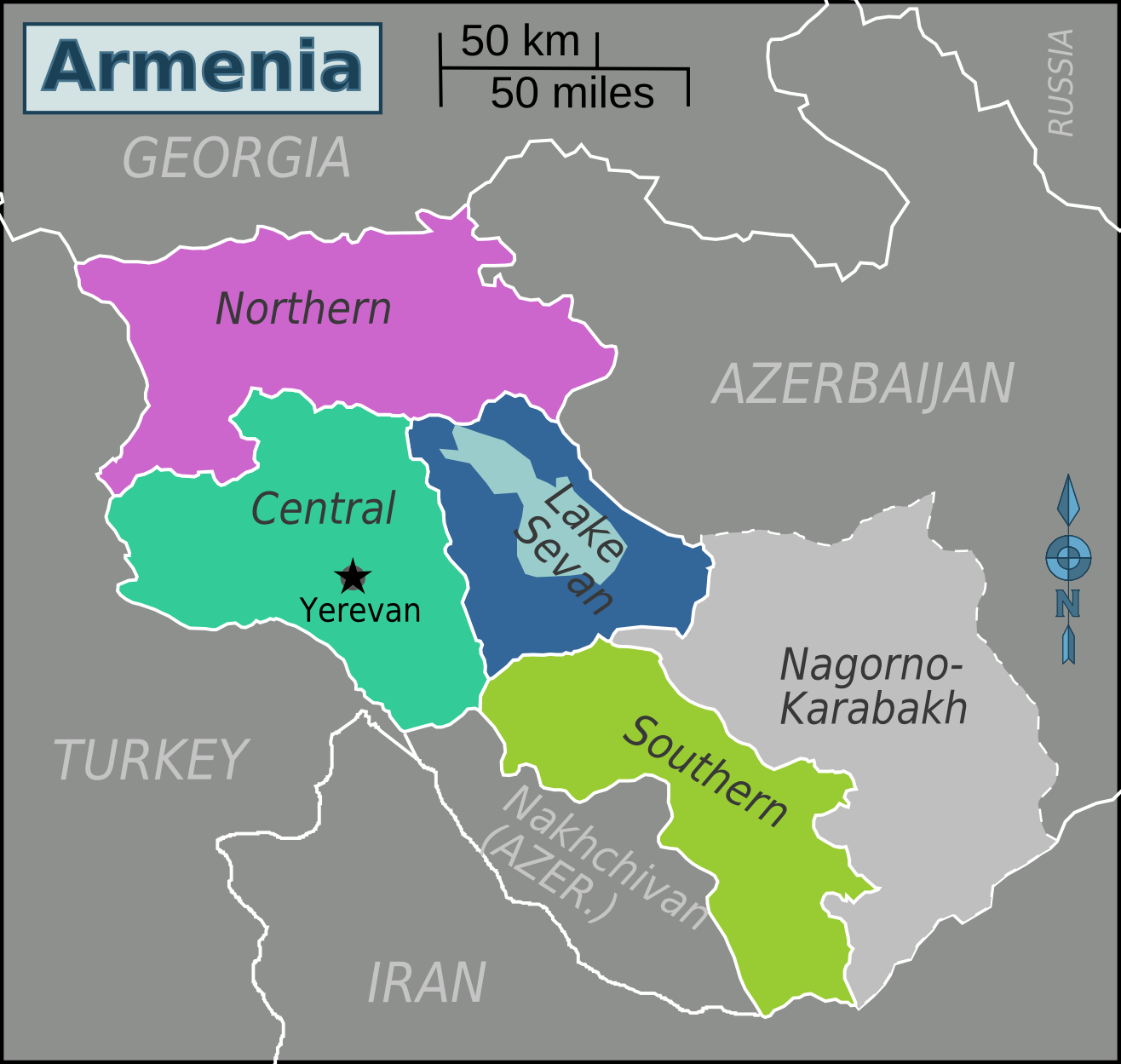
English: Map of Armenia. |
| 日期 | |
| 來源 | 自己的作品 based on Armenia provinces english.png by Golbez |
| 作者 | Peterfitzgerald (Peter Fitzgerald)) |
| 其他版本 |
.png)
授權條款

|
已授權您依據自由軟體基金會發行的無固定段落、封面文字和封底文字GNU自由文件授權條款1.2版或任意後續版本,對本檔進行複製、傳播和/或修改。該協議的副本列在GNU自由文件授權條款中。 |
This file is licensed under the Creative Commons Attribution-Share Alike Attribution-Share Alike 4.0 International, 3.0 Unported, 2.5 Generic, 2.0 Generic and 1.0 Generic license.
- 您可以自由:
- 分享 – 複製、發佈和傳播本作品
- 重新修改 – 創作演繹作品
- 惟需遵照下列條件:
- 姓名標示 – 您必須指名出正確的製作者,和提供授權條款的連結,以及表示是否有對內容上做出變更。您可以用任何合理的方式來行動,但不得以任何方式表明授權條款是對您許可或是由您所使用。
- 相同方式分享 – 如果您利用本素材進行再混合、轉換或創作,您必須基於如同原先的相同或兼容的條款,來分布您的貢獻成品。
原始上傳日誌
| This file was imported from Wikivoyage WTS. |
The original description page was here. All following user names refer to wts.wikivoyage-old.
- 2007-05-30 23:25 (WT-shared) Peterfitzgerald archive copy at the Wayback Machine 750×757 (55984 bytes) {{Imagecredit|credit=Peter Fitzgerald, based on work by [http://commons.wikimedia.org/wiki/User:Golbez Golbez]|captureDate=30 May 2007|locat (Import from wikitravel.org/shared)
- 2007-05-31 17:35 (WT-shared) Peterfitzgerald archive copy at the Wayback Machine 826×947 (145388 bytes) {{Imagecredit|credit=Peter Fitzgerald, based on work by [http://commons.wikimedia.org/wiki/User:Golbez Golbez]|captureDate=31 May 2007|locat (Import from wikitravel.org/shared)
- 2007-05-31 17:55 (WT-shared) Peterfitzgerald archive copy at the Wayback Machine 1010×947 (173069 bytes) {{Imagecredit|credit=Peter Fitzgerald, based on work by [http://commons.wikimedia.org/wiki/User:Golbez Golbez]|captureDate=31 May 2007|locat (Import from wikitravel.org/shared)
- 2007-06-15 01:49 (WT-shared) Peterfitzgerald archive copy at the Wayback Machine 1239×1196 (225910 bytes) (Import from wikitravel.org/shared)
- 2008-12-22 18:02 (WT-shared) Raffikojian[失效連結] 1239×1196 (205450 bytes) (Import from wikitravel.org/shared)
檔案歷史
點選日期/時間以檢視該時間的檔案版本。
| 日期/時間 | 縮圖 | 尺寸 | 使用者 | 備註 | |
|---|---|---|---|---|---|
| 目前 | 2013年1月1日 (二) 06:35 | | 1,316 × 1,249(259 KB) | Travelpleb | Consolidated regions, Added capital |
| 2012年12月30日 (日) 18:06 |  | 1,316 × 1,249(291 KB) | Travelpleb | Added scale & neighboring countries. Showed ''de facto'' borders rather than ''de jure''. | |
| 2012年11月21日 (三) 12:02 |  | 1,239 × 1,196(201 KB) | OgreBot | (BOT): Reverting to most recent version before archival | |
| 2012年11月21日 (三) 12:02 |  | 1,239 × 1,196(221 KB) | OgreBot | (BOT): Uploading old version of file from wts.wikivoyage; originally uploaded on 2007-06-15 01:49:10 by (WT-shared) Peterfitzgerald | |
| 2012年11月21日 (三) 12:02 |  | 1,010 × 947(169 KB) | OgreBot | (BOT): Uploading old version of file from wts.wikivoyage; originally uploaded on 2007-05-31 17:55:32 by (WT-shared) Peterfitzgerald | |
| 2012年11月21日 (三) 12:02 |  | 826 × 947(142 KB) | OgreBot | (BOT): Uploading old version of file from wts.wikivoyage; originally uploaded on 2007-05-31 17:35:14 by (WT-shared) Peterfitzgerald | |
| 2012年11月21日 (三) 12:02 |  | 750 × 757(55 KB) | OgreBot | (BOT): Uploading old version of file from wts.wikivoyage; originally uploaded on 2007-05-30 23:25:46 by (WT-shared) Peterfitzgerald | |
| 2012年11月18日 (日) 05:52 |  | 1,239 × 1,196(201 KB) | MGA73bot2 | {{BotMoveToCommons|wts.oldwikivoyage|year={{subst:CURRENTYEAR}}|month={{subst:CURRENTMONTHNAME}}|day={{subst:CURRENTDAY}}}} == {{int:filedesc}} == {{Information |description=Map of Armenia's Regions. A map outlining proposed regions for Armenia, Armeni... |
檔案用途
下列頁面有用到此檔案:
全域檔案使用狀況
以下其他 wiki 使用了這個檔案:
- el.wikivoyage.org 的使用狀況
- en.wikivoyage.org 的使用狀況
- he.wikivoyage.org 的使用狀況
- incubator.wikimedia.org 的使用狀況
- it.wikivoyage.org 的使用狀況
- ja.wikivoyage.org 的使用狀況
- pt.wikivoyage.org 的使用狀況
- vi.wikivoyage.org 的使用狀況