File:ISS-20 Caribbean island of Hispaniola from the ISS.jpg
本预览的尺寸:800 × 532像素。 其他分辨率:320 × 213像素 | 640 × 426像素 | 1,024 × 681像素 | 1,280 × 852像素 | 2,560 × 1,703像素 | 4,256 × 2,832像素。
原始文件 (4,256 × 2,832像素,文件大小:1.17 MB,MIME类型:image/jpeg)
摘要
| 描述 |
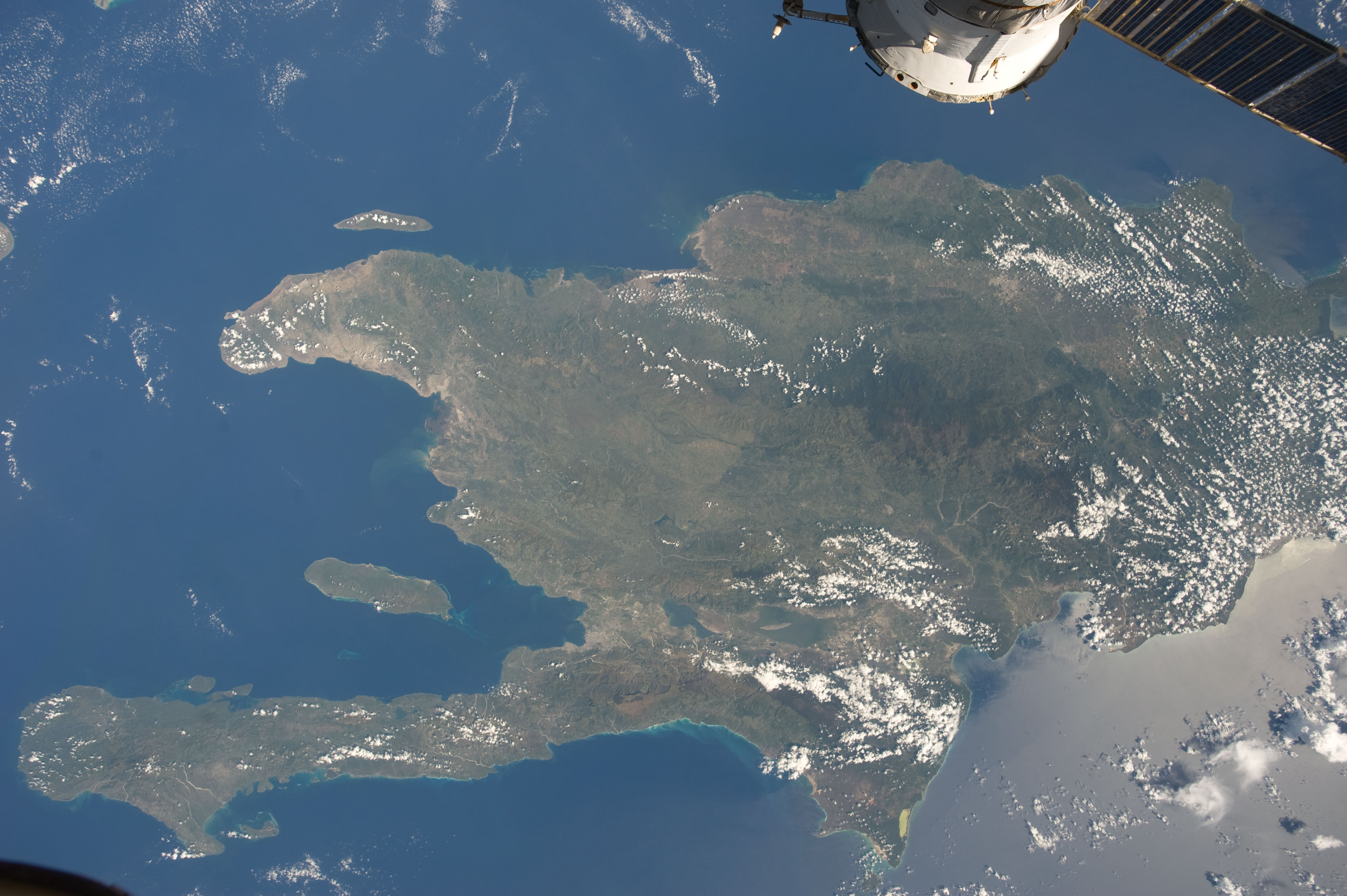
English: A view of the Caribbean island of Hispaniola from the International Space Station. This island is comprised of Haiti (in the center left of the image) and the Dominican Republic and is part of the Greater Antilles island chain which lies along the geological border of the North America Plate and the Caribbean Plate. A major fault line in the region, Enriquillo-Plantain Garden Fault, runs along the longer peninsula, in the foreground, and just south of Port-au-Prince. Part of a docked Russian spacecraft can be seen in the foreground. The epicenter of the disastrous 2010 earthquake occurred near this fault. This image was taken by the Expedition 20 crew on the International Space Station on Sept. 28, 2009 using a 25 mm lens setting. |
| 日期 | |
| 来源 | http://spaceflight.nasa.gov/gallery/images/station/crew-20/html/iss020e043301.html |
| 作者 | NASA/Expedition 20 crew |
| 其他版本 |
本图像或视频收录于美国国家航空航天局 (NASA)休斯顿太空中心(Johnson Space Center),其照片编号是: ISS020-E-043301 此标签不表示文件的著作权状态。任何文件在附有此标签的同時还需要一个有效的著作权标签。请参阅许可协议说明页面以了解更多信息。 其他语言:
|
许可协议
| 本文件完全由NASA创作,在美国属于公有领域。根据NASA的版权方针,NASA的材料除非另有声明否则不受版权保护。(参见Template:PD-USGov/zh、NASA版权方针页面或JPL图片使用方针。) | ||
 |
警告:
|
文件历史
点击某个日期/时间查看对应时刻的文件。
| 日期/时间 | 缩略图 | 大小 | 用户 | 备注 | |
|---|---|---|---|---|---|
| 当前 | 2012年6月23日 (六) 04:18 | | 4,256 × 2,832(1.17 MB) | Ras67 | {{Information |Description={{en|1=A view of the Caribbean island of Hispaniola from the International Space Station. This island is comprised of Haiti (in the center left of the image) and the Dominican Republic and is part of the Greater Antilles isla... |
文件用途
没有页面使用本文件。
全域文件用途
以下其他wiki使用此文件:
- ar.wikipedia.org上的用途
- ast.wikipedia.org上的用途
- az.wikipedia.org上的用途
- ba.wikipedia.org上的用途
- ca.wikipedia.org上的用途
- ceb.wikipedia.org上的用途
- cy.wikipedia.org上的用途
- de.wikipedia.org上的用途
- es.wikipedia.org上的用途
- eu.wikipedia.org上的用途
- fi.wiktionary.org上的用途
- fr.wikivoyage.org上的用途
- ga.wikipedia.org上的用途
- hsb.wikipedia.org上的用途
- ht.wikipedia.org上的用途
- hy.wikipedia.org上的用途
- ia.wikipedia.org上的用途
- lb.wikipedia.org上的用途
- no.wikipedia.org上的用途
- pap.wikipedia.org上的用途
- pl.wikipedia.org上的用途
- pnb.wikipedia.org上的用途
- ro.wikipedia.org上的用途
- sv.wikipedia.org上的用途
- tg.wikipedia.org上的用途
- uk.wikipedia.org上的用途
- uz.wikipedia.org上的用途
- vec.wikipedia.org上的用途
- www.wikidata.org上的用途